
Here’s a list of some of the most common cloud types you might spot in the sky.
High Clouds (16,000-45,000 feet)
Cirrus
Cirrostratus
Cirrus clouds are thin, wispy clouds composed primarily of ice crystals. Their feather-like appearance forms when high-altitude winds stretch and disperse the crystals into long, delicate streaks.
Weather signal: Changing conditions are likely approaching.
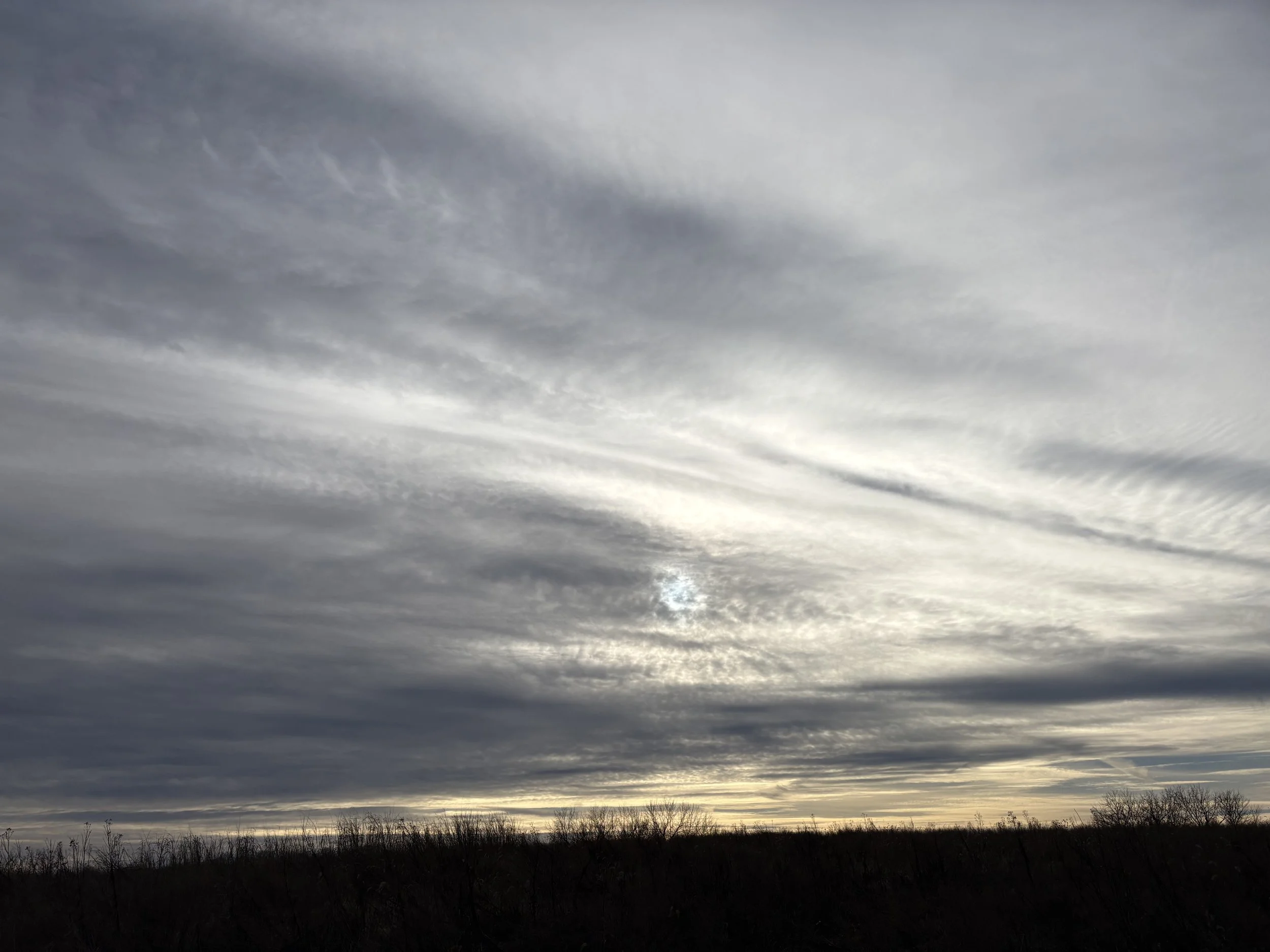
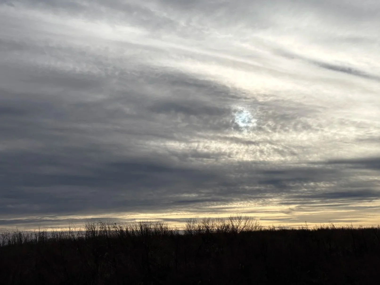
Cirrostratus clouds are thin, pale clouds that spread across the entire sky in a uniform, veil-like layer. They are most common during the winter months and often produce a halo around the sun or moon due to the refraction of light through ice crystals.
Weather signal: Steady precipitation, such as rain or snow, is likely within the next 24 hours.
Cirrocumulus
Cirrocumulus clouds are thin, patchy, and often appear as small, grainy or rippled sheets high in the sky.
Weather signal: Generally fair but cold conditions. In tropical regions, however, they can indicate an approaching hurricane.
Mid-level Clouds (6,500-23,000 feet)
Altocumulus
Altostratus
Nimbostratus
Altocumulus clouds appear as patchy white or gray layers, often forming rows of small, fluffy ripples. They are lower than cirrus clouds but still high in the sky and are composed of liquid water droplets. These clouds rarely bring rain.
Weather signal: Generally fair conditions.
Altostratus clouds are gray to blue-gray clouds that form in the middle levels of the sky and consist of both ice crystals and water droplets. They typically cover the sky completely.
Weather signal: Expect continuous rain or snow.
Nimbostratus clouds are thick, dark gray clouds that often blend seamlessly with falling rain or snow, frequently blocking out the sun.
Weather signal: Overcast skies with steady rain or snow.
Low Clouds (less than 6,500 feet)
Cumulus
Stratus
Cumulonimbus
Cumulus clouds are fluffy, white clouds that resemble cotton balls floating in the sky. Their varied shapes and sizes make them especially striking at sunset.
Weather signal: Generally fair weather.
Stratus clouds appear as thin, white sheets that spread across the entire sky. Because of their lightness, they rarely bring significant rain or snow. In hilly or mountainous areas, they can resemble fog.
Weather signal: Fair but overcast conditions.
Stratus clouds appear as thin, white sheets that spread across the entire sky. Because of their lightness, they rarely bring significant rain or snow. In hilly or mountainous areas, they can resemble fog.
Weather signal: Fair but overcast conditions.
Stratocumulus
Stratocumulus clouds are patchy gray or white clouds that sometimes form a dark, honeycomb-like pattern in the sky.
Weather signal: Generally fair weather, though a storm could be approaching.
Special Clouds
Contrails
Mammatus
Orographic
Contrails are clouds formed by high-flying jet airplanes. They consist of water droplets created when water vapor from the aircraft’s exhaust condenses in the cold upper atmosphere.
Weather signal: Contrails can reveal information about moisture levels and conditions in the upper sky.
Orographic clouds form when air is forced to rise over mountains, hills, or other obstacles. They can also develop along sea breezes or where two air masses meet, often appearing as linear cloud formations.
Weather signal: A potential early sign that afternoon thunderstorms may develop.
Stratus clouds appear as thin, white sheets that spread across the entire sky. Because of their lightness, they rarely bring significant rain or snow. In hilly or mountainous areas, they can resemble fog.
Weather signal: Fair but overcast conditions.
Lenticular
Lenticular clouds are smooth, lens- or almond-shaped clouds that can even resemble flying saucers. Their unique shapes form when air flows over hills, mountains, or even flat terrain.
Weather signal: No specific weather is indicated.