
El Níno
The tropical Pacific is undergoing a rapid, high-velocity transition toward a major El Niño event, with NOAA officially maintaining an El Niño Watch for 2026. This shift is driven by verified atmospheric mechanics, specifically intense westerly wind bursts that have reversed the traditional equatorial trade winds and allowed deep ocean heat content to surge eastward for six consecutive months. The Climate Prediction Center's latest May probability metrics place the odds of a full onset at eighty-two percent by mid-summer, climbing to a near-certain ninety-eight percent probability that it dominates the global weather pattern through the upcoming winter.
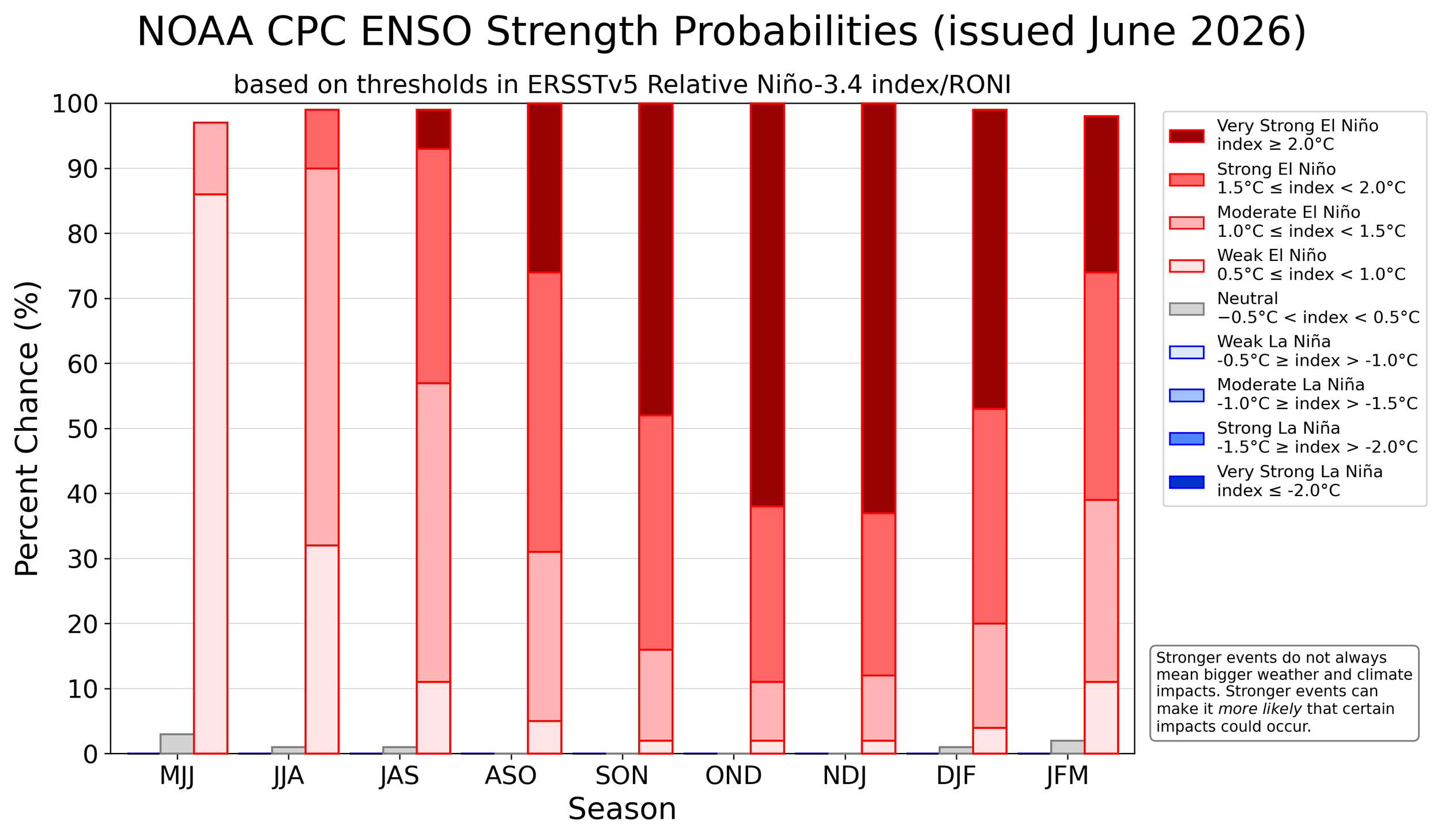
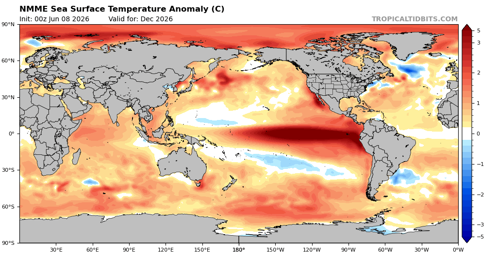
While a standard "strong" event requires sea surface temperatures to reach just one and a half degrees Celsius above normal, the May 8, 2026, North American Multi-Model Ensemble run is projecting an exceptionally rare, high-intensity setup. The raw model data features a massive equatorial plume maxing out scales at three to five degrees Celsius above average, placing this event firmly into "Super El Niño" territory. This represents a planetary-scale climate engine powerful enough to trigger severe downstream anomalies, ranging from a suppressed summer monsoon season in South Asia to heightened coastal high-tide flooding risks across the United States.
An ocean warming event of this magnitude completely alters the North American jet stream configuration. A mature winter El Niño anchors an active, moisture-laden southern-track jet stream across California, the Gulf Coast, and Florida, locking those regions into a cool, stormy winter pattern. Conversely, the northern polar jet stream is pushed deep into Canada, starving the northern half of the country of consistent arctic air. For the St. Louis metro area, our geographical position sits right on the transition zone between these two regimes; however, during historic-strength events, the northern mild signal usually dominates, heavily favoring a warmer-than-average winter with below-normal seasonal snowfall. Local forecasters must still monitor the pattern closely, as any energetic southern storm system pulling northward can easily collide with residual cold air to create localized heavy, wet snow events.
As a critical piece of meteorological context, this extreme data must be caveated by the spring predictability barrier. Climate models initialized during the month of May inherently possess lower skill scores because the atmosphere is in a state of seasonal flux, and long-range computers have a documented tendency to over-hype or "overshoot" the ultimate intensity of an oncoming ENSO cycle. While a formidable El Niño is effectively a certainty this year, these eye-popping four-to-five-degree anomaly maps should be treated as an aggressive, upper-end ceiling until we establish model consistency over the summer months.